 Switchback Ledger
Read the
shape of
the land.
Find the climb, trace the creek, and read what the lines on a topographic map tell you before you head out.
Learn the contour lines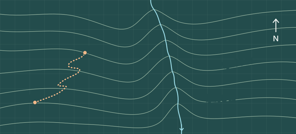
What the lines tell you
- Elevation
- A contour joins points at the same elevation. The contour interval tells you the change in elevation from one line to the next. Look for the interval and its units in the map margin.
- Slope
- On the same map, closely spaced contours mark a steeper slope. Widely spaced lines mark gentler terrain. Compare the spacing where your route actually crosses the lines.
- Stream valleys
- Where contours cross a stream, the bends point upstream. In the practice map, the stream flows south while the contour bends point north.
Trace A to B
Point A sits on the 1,200-foot line. The dotted route climbs through three 40-foot intervals to point B. What elevation does it reach?
Show the elevation
1,320 feet. The route crosses 1,240 and 1,280 feet before arriving at 1,320 feet, for a gain of 120 feet on this climb.
Before you use a real map
- Find north, the map scale, and the contour interval.
- Read the legend to distinguish trails, roads, and water features.
- Check the map date and confirm current access and conditions with the land manager.